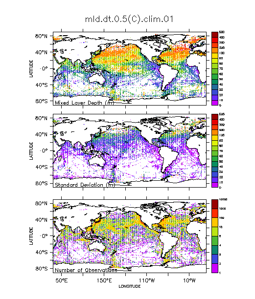
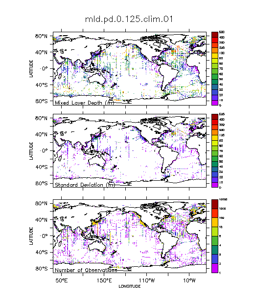
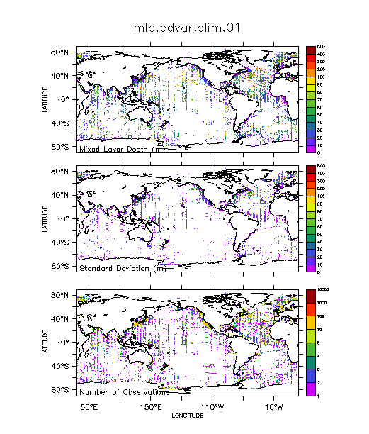
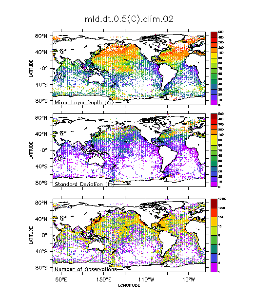
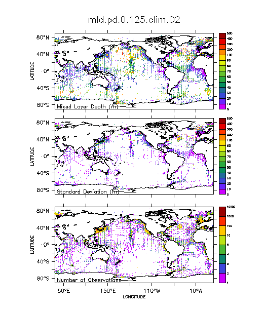
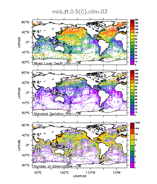
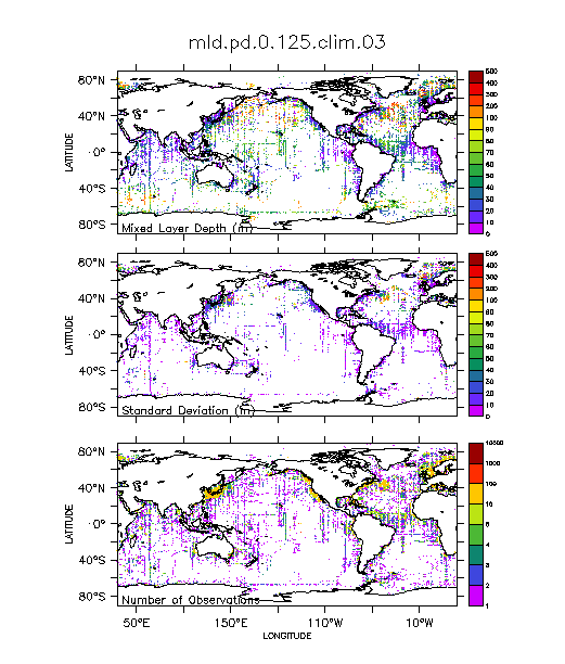
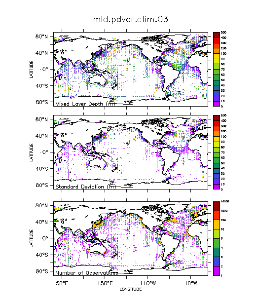
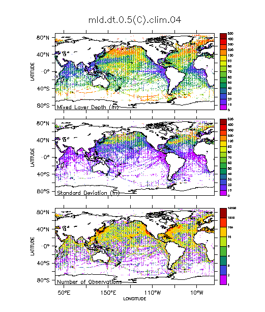
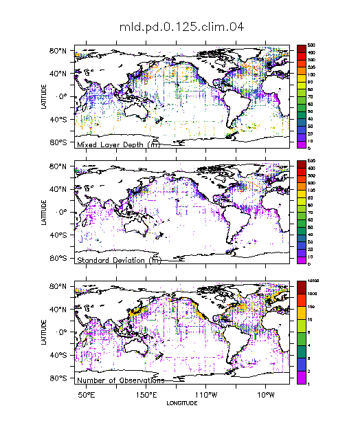
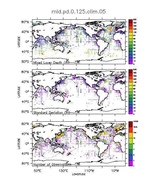
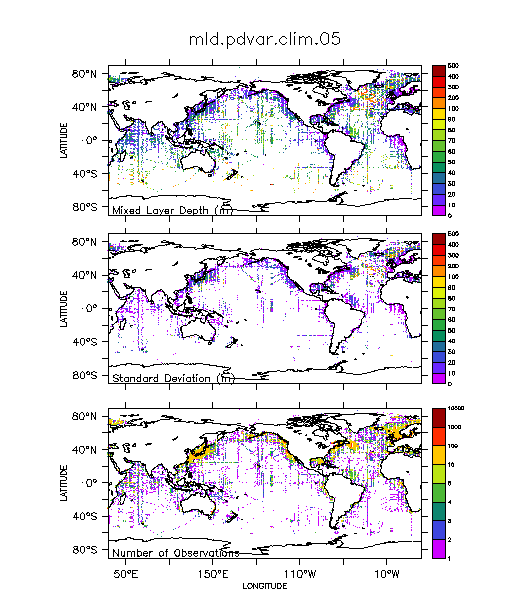
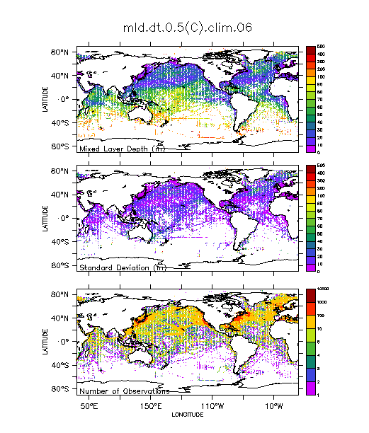
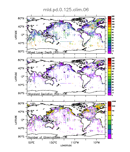
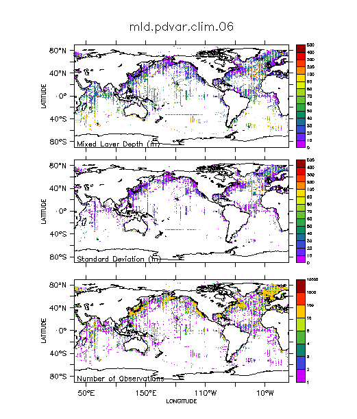
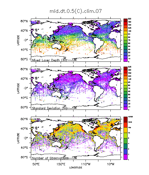
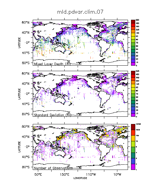
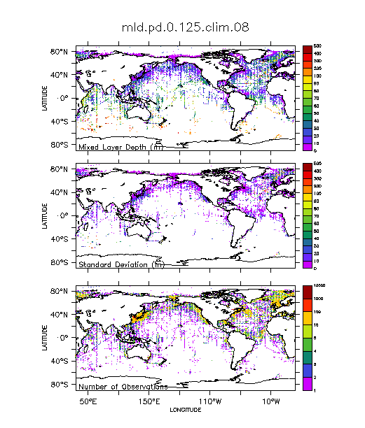
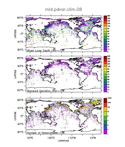
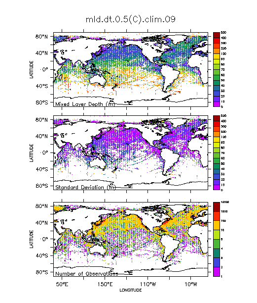
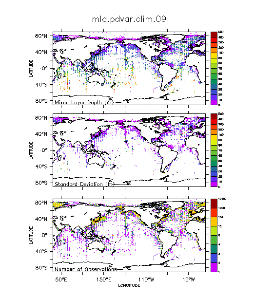
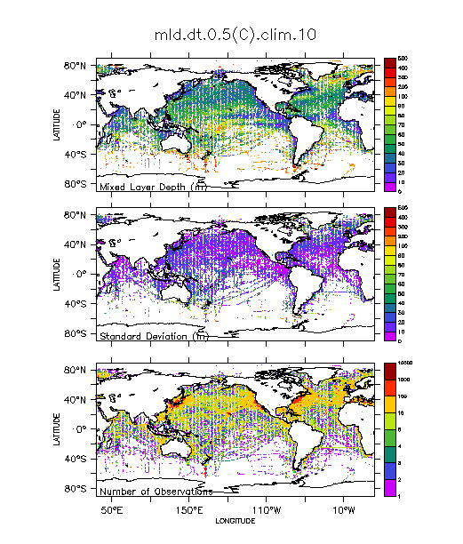
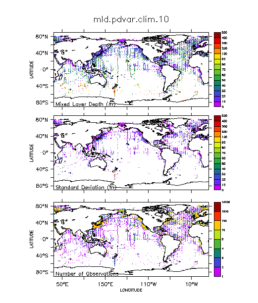
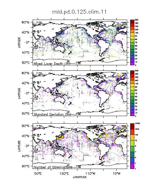
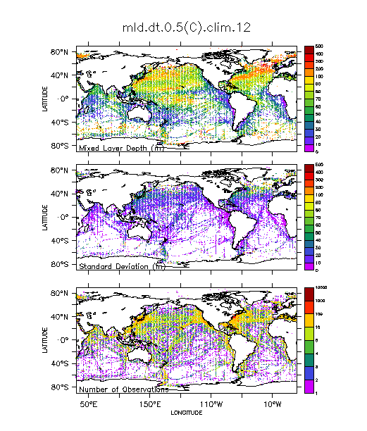
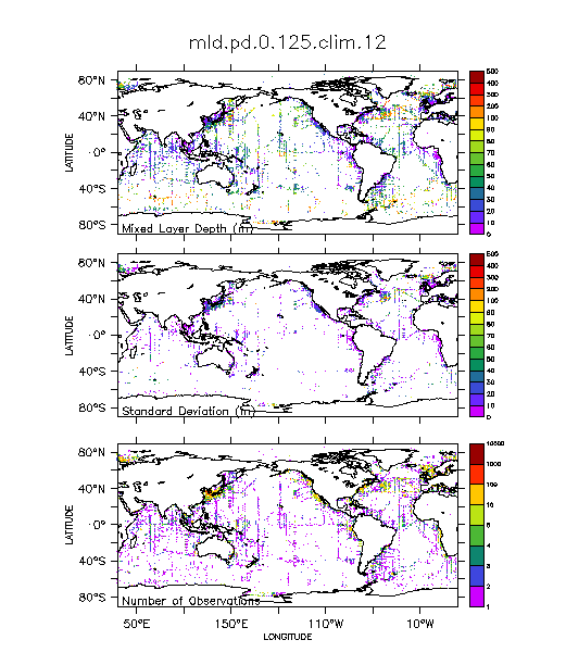
Climatologies: Mixed Layer Depth
Global climatological monthly mean mixed layer depth (mld) files
are computed by processing observed individual profiles of temperature
and salinity available from the World Ocean
Data Base 1998 based on
three mld criteria
and consequently averaged within the climatological months
and within 1 by 1 degree boxes.
No horizontal interpolation is used. Areas with no observations are shown as blank.
Abbreviations:
| mixed layer depth | |
| mld based on constant temperature criterion | |
| mld based on constant potential density criterion | |
| mld based on variable potential density criterion |
Each image contains maps of mixed layer depth (mld) in meters, its standard deviation in meters, and number of observations.
| mld.t.01 | mld.pd.01 | mld.pdvar.01 | |
| mld.t.02 | mld.pd.02 | mld.pdvar.02 | |
| mld.t.03 | mld.pd.03 | mld.pdvar.03 | |
| mld.t.04 | mld.pd.04 | mld.pdvar.04 | |
| mld.t.05 | mld.pd.05 | mld.pdvar.05 | |
| mld.t.06 | mld.pd.06 | mld.pdvar.06 | |
| mld.t.07 | mld.pd.07 | mld.pdvar.07 | |
| mld.t.08 | mld.pd.08 | mld.pdvar.08 | |
| mld.t.09 | mld.pd.09 | mld.pdvar.09 | |
| mld.t.10 | mld.pd.10 | mld.pdvar.10 | |
| mld.t.11 | mld.pd.11 | mld.pdvar.11 | |
| mld.t.12 | mld.pd.12 | mld.pdvar.12 |
| read instructions | |||
| mld.t.01 | mld.pd.01 | mld.pdvar.01 | |
| mld.t.02 | mld.pd.02 | mld.pdvar.02 | |
| mld.t.03 | mld.pd.03 | mld.pdvar.03 | |
| mld.t.04 | mld.pd.04 | mld.pdvar.04 | |
| mld.t.05 | mld.pd.05 | mld.pdvar.05 | |
| mld.t.06 | mld.pd.06 | mld.pdvar.06 | |
| mld.t.07 | mld.pd.07 | mld.pdvar.07 | |
| mld.t.08 | mld.pd.08 | mld.pdvar.08 | |
| mld.t.09 | mld.pd.09 | mld.pdvar.09 | |
| mld.t.10 | mld.pd.10 | mld.pdvar.10 | |
| mld.t.11 | mld.pd.11 | mld.pdvar.11 | |
| mld.t.12 | mld.pd.12 | mld.pdvar.12 |